Friday 4 May 2007

Into Tunisia

The Mediterranean coast of Algeria is to be avoided for security reasons, and the central deserts are not as dramatic as those of the South, comprising of difficult sand seas, or Ergs. So, like most foreign travellers on the route, we made for Tunisia, covering the remaining 600km to the border at Taleb Larbi in another long day.

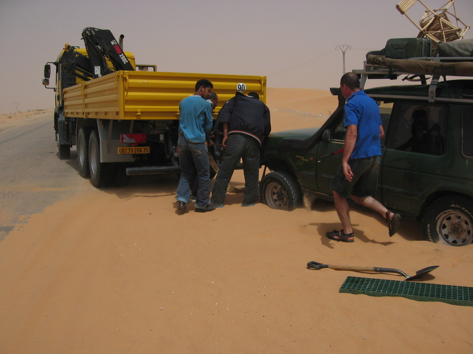
Stuck one last time, rescued by a truck

Approaching the Tunisian border 

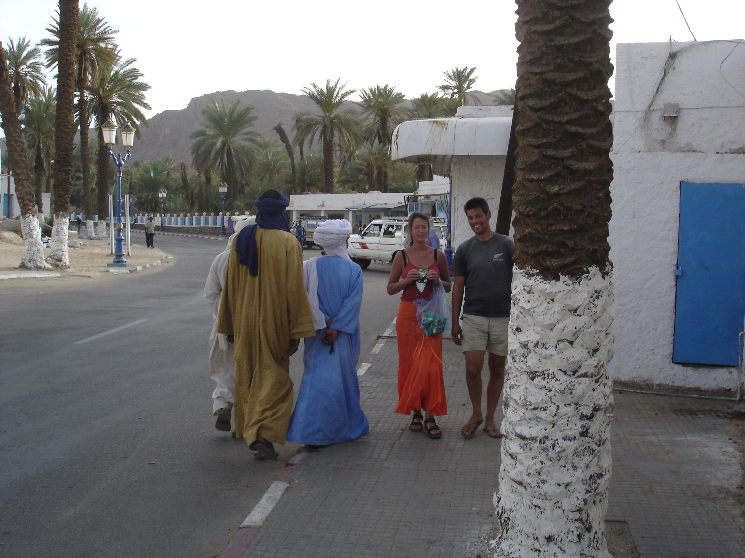
At El Oeud, a well populated series of oases, we tanked up to the maximum with 15c diesel. The next fuel (in Tunisia) would cost three times more (and then three times more again in Italy). Djafar guided us through the last couple of hours of officialdom, and pocketed his tip and present without looking at it. We said our goodbyes, we will miss his company after a very enjoyable couple of weeks.

Farewell to our Algerian Guide 

The officials at both borders only glanced at the car contents, I think they are a bit intimidated by the amount of gear and would not know where to start a search. The Tunisian Customs asked if we have any electronics - they have a thing about GPSs - and we said "No". Since every single overlander car has a GPS, they evidently find it less hassle to ask and then not to look. 

Culture shock in Tezeur, the centre of Tunisian Desert Tourism. A whole neighbourhood of hotels in the Zone Touristique, ATMs that actually accept our cards, gleaming convoys of tour group 4WDs. Con was here before and remembers a much quieter place.

We did not linger. On the road north we experienced the first sprinkling of rain since Morocco. We overnighted at the holy city of Kairouan in an old fashioned hotel. It is clear we are back on the tourist trail, tourist shop-keepers start with 1000% of the next offer price. 

The Dutch went to Tunis to apply for their visas for Libya, we went to the coastal resort of Hammamet. From the shops and hotels it is indistinguishable from Agadir or any of 100 places on the Mediterranean. It has a nice beach, deserted apart from a lonely camel and its owner. We stayed at the Citroniers, where Con had been many years ago. 

Two hours of professional cleaning transformed the car, with an impressive amount of the Sahara blasted out of the back by compressor. It also got another oil change, and some attention from an electrician and a tyre shop. We have our first puncture since leaving home, thanks to a 4" nail. The tyre man asked for 100 dinar (almost €60) for the repair, and after I stopped laughing he got 10d. 

The highlight of Hammamet was the "Cultural Evening" at the big resort across the street - a band in baggy pants, belly dancers, tourist dancers. The next highlight would be leaving, with an overnight ferry from Tunis to Trapani in Sicily.

Thursday 3 May 2007

Ghardaia, Algeria

Sadly, there is no sign saying "thank you for crossing the Sahara, have a nice day". The changes come by degrees. At In-Salah we knew we would have the comfort of a tarred road all the way to the Mediterranean Sea, but there was plenty of desert scenery to enjoy along the way, as we skirted the Grand Erg Occidental to our West and later, the immense Grand Erg Oriental was to be our companion to the Tunisian border.
  

It was a long day of driving, over 600km from In-Salah to Ghardaia, made more tiresome by Gendarmerie checkpoints. It seems our fiche has been copied so many times it is no longer legible, and they must transcribe our passports, a slow business. Claire managed to scrounge fresh bread from the police at one checkpoint, a nice return after all the stuff police have scrounged from us elsewhere (not in Algeria mind).

The oases became more frequent, until we reached the biggest, the five oasis towns centred on Ghardaia. Haakon had gone ahead with his own guide from In-Salah, but we met again in the town centre, and after dinner they showed us the way to a hotel, a few kilometers from the town. We followed narrow streets and groves of palms until we reached a high walled compound, an old kasbah with beautiful grounds. A really magical old building with random steps and low ceilings, full of local artifacts. I don't know the name, none is shown outside, but the coordinates are N 32 deg 29' 296, E 3 deg 40' 802. 

With another long drive ahead, a pleasant town and lodgings, we decided to stay a second night. We had a restful day, venturing out only for a haircut (Con scalped) and a browse in a junk shop. I am really enjoying Algeria. It is not just the comfortable temperature, the cheap fuel and good coffee, but it feels like a country rich in history, stoically enduring another time of difficulty, like the Lebanon. And it helps that the people are so nice, the first time in Africa that it has been possible to walk the streets without uninvited interruptions.

Later in the afternoon we explored one of the walled towns, Beni Isguen. Although the numbers of tourists are low, the residents are well organised. We must enter by a particular gate, where we were met by a guide and shown the small museum. Our guide spoke a rather entertaining English learned while working at the airport at Southend-on-Sea, and he handled our questions with good humour. His people are Berber, and from a particular Islamic sect - the Ibadi - that is more common in Oman. They are conservative, and the women wear white, and married women peer out from their headscarves with one eye only. I am very sorry we did not have a camera, as Con had departed in a hurry wearing shorts. He needed to cover up, but nothing in his size was available, so he ended up wearing a knee length smock that served to emphasise his hairy shins, and would he would have fitted in well in The Life of Brian.

The Town of Beni Isguen

We took in a view of four of the five oasis towns from a tower at the highest point of the town. The five are now joined by Arab communities, and relations seem to be good. We finished our walk in the market square, full of old men chatting. Perhaps it is an indication of the austere sect, but there were no games of dominoes or cards, no hookahs, and no drinking, not even a coffee.

Monday 30 April 2007

Djanet to In-Salah - Part II


The next day, we rounded the northern end of the Tefedest Mountains and approached the base of Jebel Djanoun (above). At 2300m it would be a good two hour climb from our level at 1000m, so instead Leon and I tackled a smaller peak which Djafar named "Jebel Tourist" in our honour. 

We crossed a wide section of piste running North-South, that Djafar said is used by cigarette smugglers. Then we reached the main road that links Tamanrasset to the North, and Djafar paid a short visit to a lonely mosque at Sidi Moulay Lahsene. Following tracks 20km to the West, he brought us to the best camp of the whole journey. The area has mountains of smooth grey volcanic rock, steep sided with rounded tops. I don’t know the geology, perhaps volcanic extrusion, but the shapes are not unlike Ayers Rock.
 
The volcanic hills at Tesnou - for scale, note the Land Rover above and people below


My Favourite Sahara Camp


On the fifth day of the journey from Djanet to In-Salah we had another first, as Con lifted the food box to disturb a pale scorpion who darted away under the car. It was an easy run up 120km of tar to Arak where we could refuel and water. The only shop had very little fresh food, but we got potatoes and stocked up with luxuries like yoghurt and sugary chocolate. Then we had our last section of Sahara piste, turning off just North of Arak onto part of the old Hoggar route. There was plenty of security around in Algeria, and at Tadjemout we were intercepted by an army pick-up. The whole oasis was swarming with soldiers, even up the trees and behind rocks in the hills behind. Djafar waved the magic piece of paper – and on we went. 

Maybe after a lot of desert we were getting jaded, but I found it a rather boring route, wind-blasted and tiring. We have been gradually descending for the last couple of days, and it is hotter again, almost 40C. As the piste has been superceded by a tarred road that runs to the West, it is no longer maintained, so every time we got to third gear we’d find the track washed out and would need to slow and crawl over boulders. We spotted a couple of gazelles, dancing away across the rocks.


Our best camp was followed by one of the worst, windswept and insecty, a bad combination. Giant camel spiders (solpugids) scuttled around. But even that camp was better in the calm of morning, and I’d rather be in the desert than any of the towns. For reasons unknown, it seems that Djafar set fire to the nearby oasis grass.


As we got closer to the tar again we met Haakon returning at speed. He’d heard gunfire ahead, and soon we could hear it too, heavy machine guns and explosions. The most likely explanation was army exercises, and Djafar agreed – he knew there was a base a little ahead, and waved us on. However, he got a severe ticking off from the army once we reached their checkpoint. He wasn't intimidated, and brandished our fiche, which includes the route as registered with the Gendarmerie. I suppose the army, and most Algerians, cannot understand why tourists would want to travel a washed-out old piste when there is a nice tar road instead. But with thousands of square miles of desert you’d think they’d find somewhere else to practise, not near a tourist route, no matter how few we are.


In-Salah: A helpful list of some of the worst towns in North Africa (Tamanrasset excepted) 


At In-Salah, Mohammed Haffaoui of Tanezrouft Voyages entertained us in the courtyard of his home, reclining on cushions and carpets. The delicious meal of salads, couscus, mutton and sauce was prepared by one of his wives, a native of Timbuktu. We treated ourselves to the best hotel in town, probably the only place for a thousand miles that serves beer.

Thursday 26 April 2007

Djanet to In-Salah - Part I

Although we had a rough programme - hand written on a piece of paper in a Tamanrasset restaurant - we were never quite sure what to expect each day. I am sure Djafar had a fairly clear idea as to our route and where we would camp each night, but it was difficult to communicate anything beyond the day at hand. So, we set off again from Djanet not certain if we’d be camping for three, four or five nights. Djafar warned us to bring maximum fuel and water. There was a short queue at the filling station – being close to Niger means that a lot of the local fuel disappears over the border. Then, down to the oeud where a tap delivered water from below the sand. The market veggies looked well travelled, but we bought what we could and put them in a cloth bag and sprayed it with water. Also got a tray of eggs and a whole Edam cheese.

Main street, Djanet with Claire and Leon

On the first day we travelled north via Route National 3, turning off to explore a couple of canyons in the Tassili to the East. This is a beautiful area of eroded pinnacles.


At the deepest extent of the Essendilene Canyon was a murky green pool, but not enticing for a swim at this time of year. Haakon’s bike is very heavy, even though we carried his spare fuel and water, and hard to keep upright in heavy sand. If the bike goes over, he must get help to lift it, or else unload his bags. When he did not appear for a while we went back to look for him, and managed to get badly stuck in the sand.

Stuck, again


For the next few days we meandered West and North West on the Route de Djafar. A diversion took us along a rocky track to deep guelta, where I enjoyed my one and only Sahara swim.

10% camel pee apparently

We passed South of Mt Tazat, and for a while travelled back on our eastward route. Somewhere along the way we passed the 10,000 mile mark. 

As always, Djafar knows good places to camp, and led us to a sheltered spot with a view of spectacular high dunes. As we had some daylight, Leon decided to show us some dune driving, but was stuck before he left the camp. To be fair, the Dutch car handled the sand pretty well, and they rarely resorted to dropping tyre pressure. 

As we sat on the crest of the dune in evening light, a lone Tuareg and his camels appeared on cue, crossing the plain below, the only other human we’d seen all day.


A Rare Excursion Onto a Dune

On April 16, we continued West towards the Tefedest mountains. Our lunch break was in an oeud with a concrete lined well. Since we only have enough water for drinking and cooking, we used the chance to drag up buckets of water from 30m below for a wash and shave. 

We set camp in an area of tree islands, where erosion had left the root systems exposed so that each little tree was sitting on its own five metre high platform, one of which provided us with a windbreak. We have been eating well, and this night was especially good: aubergines fried with garlic in olive oil, then layered with tomatoes, tinned mushrooms and slices of Edam; all wrapped in tin foil and buried under the fire for half an hour.


This blog is the diary of a journey through the Sahara undertaken February-May 2007. The most recent post is first.